Pages

Thursday, September 8, 2011

Sorry I did not finish last post

OK, I have heard from a lot of you that I did not finish the last post.  So here we go

Well I know we have been remiss in keeping you all up to date.  So when we last updated the blog Jen and I had decided to leave the boat in Baltimore for a while so we could fly out to Seattle to take care of work commitments.  So when we returned Jen still had lots of commitments and I recruited Captain Bob from Truform to come with me to get Master Plan back to East Greenwich.  On Wednesday, May 3, we rented a car in Providence and drove down to Baltimore via New Jersey.  The Jersey turnpike lived up to its reputation as a Traffic PIA.  A 6 hour drive turned into 9 hours.  Not a lot of fun.  We spent Thursday getting the boat ready to roll.  This included making a run to the fuel dock to feed the bitch.  This was not a lot of fun my nerves or wallet as it was blowing a good 25 knots in the harbor.  After checking the weather Friday looked good for departure up the Chesapeake the the C&D (Chesapeake and Delaware) Canal.

On Friday Morning Bob and I spent a very nice day on the water traveling from Baltimore MD to Cape May NJ.   Spending time on a boat with Captain Bob is always an enjoyable and educational time.
 
Baltimore is just North of Annapolis on this map, Cape may is in the Bottom right corner in this map, southern tip of New Jersey 
We made the 110 mile trip to Cape May with Fair Winds and a following sea for most of the Day.  It did get a little bumpy on the bottom half of the Delaware Bay.  This was a good thing as the Delaware has a bad reputation for being a dangerous piece of water.  We settle into a slip at Utch's Marina before sunset via the fuel dock.  I had not filled the tanks all the way in Baltimore as the price of fuel in NJ tends to be lower.  I was happy as the price turned out to be about 40 cents less a gallon in NJ vs Baltimore.  After we settled in we walked across the street for a nice Prime Rib Dinner at Lucky Bones Restaurant.

At this point the weather was looking really good for the next couple of days.  When it comes to the New Jersey Coast, if you get a good weather window, you take it.  It is not that the weather on the NJ coast is particularly bad all of the time.  The issue there is that you are exposed to the north Atlantic ocean with very limited places to go and hide if the weather turns bad.  It is about 120 miles of beach with just a few viable inlets that I could squeeze Master Plan into.

So with a good weather forecast we headed out Saturday Morning.  We dropped the lines around 6:45 AM and were on our way.  On days that the weather is settled the Jersey Coast is kind of Boring.  It is a long straight passage that takes you out a few miles off the beach.    After looking at the Casinos in Atlantic City there is not much to look at.

 
Captain Bob work his magic with the ladies
We Settled into a nice anchorage behind the break water in Atlantic Highlands NJ.  This is just around the corner of Sandy Hook, the entrance to New York Harbor.  It was great to have the Jersey coast behind us.  After we made sure the anchor was good and stuck we enjoyed a nice dinner of steak and peas grilled on the back of Master Plan.  After Dinner we checked the weather one more time an all looked good for the following day.

On Sunday we weighed the anchor by 7:15 am.  We were in for a beautiful ride through New York Harbor.
The Yacht EOS gliding under the the Varazano Narrows Bridge
Getting tired will finish tomorrow

We encountered won of the biggest privately held pleasure sailing yachts in the world going under the Varazano Narrows Bridge.  The name of the yacht is EOS.  It is owned by Barry Diller, movie guy, and is 305 feet long.  The picture above does not do it justice.   You can read about it here:  http://en.wikipedia.org/wiki/Eos_%28yacht%29
Lower Tip of Manhattan  

Staten Island Ferry building in Manhattan

So with the current with us and a early start we were on our way.  The forecast was excellent for the day, but getting ugly tomorrow.    With this in mind I decided to burn copious amounts of diesel and  turn master plan into a bit of a speed boat.  That means doing 16 knots ( 1 knot equals 1.15 MPH) about twice our normal speed.  This burns about 6 times the amount of diesel.  This was a concern as we continued up long island sound.  I has topped off the tanks in Cape may previously and at this rate we it was questionable weather we could make it back to RI without stopping for fuel.  The problem was that this would eat up lots of time that I did not have.  After doing lot of calculations we continued on.  As we rounded Point Judith RI we were tossed around in rough seas dangerously low on fuel.  At that point it was after 6 pm on a Sunday night in April.  Finding an open fuel dock was going to be tough to find.  When we arrived at our home dock in East Greenwich we had less than 20 gallons on board.  In a boat that holds 550 gallons, that is very low.  Jen was waiting on the dock for us, it was 8 PM and we were finally home.  Captain Bob, myself and Jen went to our favorite restaurant, Frank and John's Pizza.  We ordered the Clams Zupa as usual.  It sure was good to be home.

Friday, May 13, 2011

Back in in Little Rhody

Well I know we have been remiss in keeping you all up to date.  So when we last updated the blog Jen and I had decided to leave the boat in Baltimore for a while so we could fly out to Seattle to take care of work commitments.  So when we returned Jen still had lots of commitments and I recruited Captain Bob from Truform to come with me to get Master Plan back to East Greenwich.  On Wednesday, May 3, we rented a car in Providence and drove down to Baltimore via New Jersey.  The Jersey turnpike lived up to its reputation as a Traffic PIA.  A 6 hour drive turned into 9 hours.  Not a lot of fun.  We spent Thursday getting the boat ready to roll.  This included making a run to the fuel dock to feed the bitch.  This was not a lot of fun my nerves or wallet as it was blowing a good 25 knots in the harbor.  After checking the weather Friday looked good for departure up the Chesapeake the the C&D (Chesapeake and Delaware) Canal.

On Friday Morning Bob and I spent a very nice day on the water traveling from Baltimore MD to Cape May NJ.   Spending time on a boat with Captain Bob is always an enjoyable and educational time.
   
Baltimore is just North of Annapolis on this map, Cape may is in the Bottom right corner in this map, southern tip of New Jersey 
We made the 110 mile trip to Cape May with Fair Winds and a following sea for most of the Day.  It did get a little bumpy on the bottom half of the Delaware Bay.  This was a good thing as the Delaware has a bad reputation for being a dangerous piece of water.  We settle into a slip at Utch's Marina before sunset via the fuel dock.  I had not filled the tanks all the way in Baltimore as the price of fuel in NJ tends to be lower.  I was happy as the price turned out to be about 40 cents less a gallon in NJ vs Baltimore.  After we settled in we walked across the street for a nice Prime Rib Dinner at Lucky Bones Restaurant.

At this point the weather was looking really good for the next couple of days.  When it comes to the New Jersey Coast, if you get a good weather window, you take it.  It is not that the weather on the NJ coast is particularly bad all of the time.  The issue there is that you are exposed to the north Atlantic ocean with very limited places to go and hide if the weather turns bad.  It is about 120 miles of beach with just a few viable inlets that I could squeeze Master Plan into. 

So with a good weather forecast we headed out Saturday Morning.  We dropped the lines around 6:45 AM and were on our way.  On days that the weather is settled the Jersey Coast is kind of Boring.  It is a long straight passage that takes you out a few miles off the beach.    After looking at the Casinos in Atlantic City there is not much to look at.

  
Captain Bob work his magic with the ladies
We Settled into a nice anchorage behind the break water in Atlantic Highlands NJ.  This is just around the corner of Sandy Hook, the entrance to New York Harbor.  It was great to have the Jersey coast behind us.  After we made sure the anchor was good and stuck we enjoyed a nice dinner of steak and peas grilled on the back of Master Plan.  After Dinner we checked the weather one more time an all looked good for the following day.

On Sunday we weighed the anchor by 7:15 am.  We were in for a beautiful ride through New York Harbor. 
The Yacht EOS gliding under the the Varazano Narrows Bridge
Getting tired will finish tomorrow


Saturday, April 16, 2011

Baltimore, MD - Master "Plan B"

Greetings family and friends - I type this from Baltimore, MD - we arrived here on Thursday and we have moved to "Plan B." 

I'll start from Wednesday night.  In looking at the weather forecast, Paul figured out pretty quickly that there was no way we would make it to Rhode Island by the middle of next week.  The trip from here requires clear weather, as a majority of if is along the Jersey coast - and if the weather isn't cooperating - it's a really tough trip.

So - we made the call Thursday morning to trek to Baltimore (about 70 miles) from Solomon's Island and keep the boat here for a month.  We rented a slip at this great marina right in the Inner Harbor in the heart of Baltimore - walking distance to grocery stores, great restaurants, great neighborhoods, etc.  Our trip on Thursday was beautiful - not a cloud in the sky and we had a easy and beautiful cruise up the Chesapeake - a far cry from earlier this week! 

The AIS info on our chart plotter.  You can click on any boat on the radar and find out the details - pretty cool.

There were at least 12 huge tanker ships waiting just south of the Chesapeake Bay Bridge for their call into Baltimore Harbor to either unload or load their cargo.

A tug pulling a barge goes by . . .

A typical site in the Chesapeake

The tug and barge head for going under the Chesapeake Bay bridge

We passed this old fort heading into Baltimore Harbor

Downtown Baltimore

Baltimore is a very active port - lots of commercial activity.

Another perspective of this active commercial hub.

I will fly to Providence tomorrow (Sunday) and work all week from our apartment and then I fly to Seattle, WA next Saturday.  I plan to visit my 92-year-old Aunt Charlotte and my cousins who live in Salem, OR (about 3 hours south of Seattle) and spend Easter with them.  Then I have a one-day Clinic in Tacoma on Saturday April 30th, so will drive back to Tacoma on Monday (after Easter) and work all week there leading up to the clinic.

Paul will fly to West Palm Beach on Monday and pick up the van and drive it back.  Our dear friend "Florida" Jack was able to get us parking at his apartment complex - so Paul will fly down on Monday, stay with Jack Monday night, and head north first thing Tuesday.  He will drive to Baltimore, stop here for a few days and do some work on the boat, then head back to Rhode Island and spend Easter with his Mom and brothers on the Cape.  He will fly to Tacoma on Wednesday (April 27) - then we both fly back together late Sunday (May 1st) after the clinic.

Are you keeping up with all of this?  :-) 

Once we get back after the clinic, Paul will head back to Baltimore with someone (still figuring this out) and will bring the boat back to Rhode Island.  I can't join him because I have a big event on May 10th, so our hope is to have Master Plan back to East Greenwich by mid-May.  Obviously, the weather forecast will impact this plan - so we'll see.

Meanwhile, we love Baltimore and we love this marina.  We met up with some wonderful friends last night and will see a few others today.  Below are some photos taken from Master Plan's bow on Thursday evening.

So - we're "busy living" and life is good.  We'll definitely keep you posted as we forge ahead with our Plan B.  Thanks so much for following along!

Lots of love, Jen & Paul

Today's Quote:
Life is what happens to you while you're busy making other plans.  - John Lennon

Wednesday, April 13, 2011

Solomon's Island, MD

Greetings from Master Plan - it has been a few days since our last post so we'll fill you in on our adventure . . .

We left Great Bridge, VA on Monday morning - the forecast was a little gloomy, so our goal was to get to Norfolk (12 miles) and hunker down.  The 12 miles we cruised included 3 bridges and a lock - so it took almost 2 1/2 hours as everything had to be timed.  We caught the 10am opening at Great Bridge and then tied up in Portsmouth, VA (right across the river from Norfolk) at about 12:30 p.m. 
The "Great Bridge" - we docked Sunday night in view of this bridge.
Right after Great Bridge, we went into the Great Bridge lock - we lowered about 3 feet before we continued on our way.
So Monday was basically me working away at the dock - and Paul and I did have a nice walk around historic Portsmouth, VA - an interesting place!  
On Tuesday morning, we untied at 6:50 AM and headed toward the Chesapeake Bay . . .
Sunrise over Norfolk from Master Plan's stern
Big ship coming into Norfolk
From the Captain's perch - the large ship passing by.
We headed up the Chesapeake without incident until about 2:30 p.m. - we were making good time and all was smooth . . .  then a storm blew across and after that, the seas kicked up and it became a bit "snotty" as they say.
We could see the storm North of us blowing across.
The purple on the radar is the pouring rain north of us - in the middle of the picture is a black dot - which represents Master Plan - we did get some rain, but we missed most of the hard stuff.  What really affected us were the rougher seas caused after the storm blew through . . .
In the distance is a large ship heading into the weather . . .
So - our tiny ship was a little tossed around, but fortunately, we were heading into it, so it was rough, but not too crazy.  Our plan had been to stop at Solomon's Island - but in order to do that, we would have had to turn the boat and then be in a beam sea (which basically means rocking side to side - not good) - so we looked at the charts and started heading Northeast into the wind and made a plan to get into a protected place.  We found the Hunga River - near Hoopersville, MD (near Salisbury - quite remote) - and found a place pretty much surrounded by land where we could anchor and be protected.  By 6:30pm, we were anchored in much calmer seas and were pretty wiped out.  It felt good to not be rocked around and be relatively stable.  All good - we cooked dinner, watched TV, and went to bed.

This morning, we saw a weather window and picked up the anchor (which was quite settled into some thick clay) and headed across the Chesapeake to our original destination - Solomon's Island.  What a different day - the seas were quite calm - but we knew we had to use our time wisely, as a small craft advisory was in affect as of 1pm.  So - off we went and we pulled into the marina at about 10:30 AM and settled in here.  The marina is fantastic - great facilities, great wifi (good for RLC Events) and the people here were super friendly.  Just what we needed!  I spent most of the day at the computer and on the phone, and Paul hit West Marine and the grocery store.  He also enjoyed a much deserved nap after yesterday  . . .

Tonight - we enjoyed a beautiful sunset and had a wonderful dinner at the marina restaurant.  We would definitely come back here - a great spot.
Sunset on Solomon's Island from Master Plan's Bow
A mallard duck works his way across the channel - beautiful.
Another shot of sunset - so pretty . . .
The weather looks good for tomorrow, so we'll head out in the morning and take it from there - as always, we promise to keep you posted!
Cheers from Master Plan - with love, Jen & Paul

Today's Quote:
What the heart gives away is never gone.  It is kept in the hearts of others.  -Robin St. John

Sunday, April 10, 2011

Great Bridge, VA - Mile 12.2

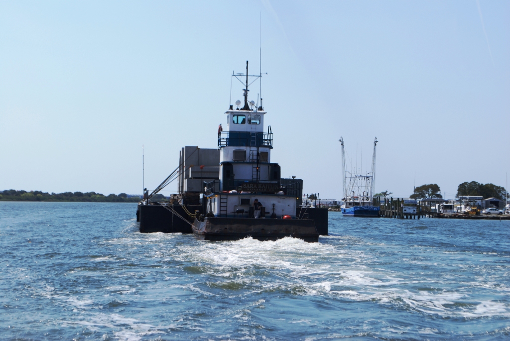
Ahoy from Master Plan!  We made it to Virginia today - one more state closer to the great state of Rhode Island!  It was beautiful today and we chartered new territory on the ICW as we took the Virginia Cut, which we had not taken on the way down . . .  and we really enjoyed it.  We pulled up the anchor just south of the Alligator River at about 7:40 a.m. this morning and started working our way North.  The sun was shining and it was a lovely day.  We saw another tug and barge today in Coinjock, NC - but it was a really LONG barge - it was actually two barges tied together . . . 

Captain Paul at the helm - you can see the barge coming by us.
If you look in the middle, you can see it is two barges tied together.

And there it goes by - pretty cool.

We also saw a lot of wildlife today -
An Osprey watches over its nest on a channel marker.  There were Osprey nests on almost every marker.  As Paul says, "don't let anyone tell you that Osprey are endangered . . ."  We saw several today!
A turtle suns itself on a log along the river.
We also saw something on the ICW that I had never seen before along the ICW - a water skier!  He had a wet suit on and was really good - jumping waves and cranking along . . .
I was at the helm and snapped this shot quickly . . . 
We also went "by" several bridges today.  Using the word "by" means that we had to ask for several to be opened.  Some bridges open on demand, but many open on the hour and the half hour only; some only open on the hour - so you need to be strategic when you're timing out the bridges.
North Landing Bridge - we caught the 4pm Opening - it was actually two pieces of bridge that swing open.
Looking back at the open bridge - two sailboats were behind us.  We actually approached the bridge last and the two sailboats were waiting, but since we move faster than they do, there was a very cordial radio exchange among all of us and they let us get up in front, as to pass them would have been inevitable once we went through the bridge. 
Centerville Turnpike Bridge - this bridge opens on the hour and half hour during the week, but since it was a Sunday, it opened on demand.  This was another swing bridge.
Looking back - and always a nice radio exchange - "Thanks for the opening!"
We arrived to the marina - Atlantic Yacht Basin - at about 5pm after traveling 90 miles.  It was LOVELY - nice warm sun and a light breeze.  We "fed the bitch," we pumped her out, and settled into our slip.  Paul changed the oil for the generator, I did some laundry, and we both took showers - very productive!  We're now going to walk to the grocery store and get a few things, then it's back to the boat to cook some dinner and relax.  
Another beautiful sunset over the Great Bridge taken from Master Plan's stern.  I just love the lighting at this time of day - especially on the water - it never gets old.
The weather tomorrow is looking rather crappy.  Because of that, our plan is to have a very short day - we have three bridges and a lock we have to get to in the next 6 miles - then we'll head to Mile 0 - Norfolk, VA - grab a slip there, and wait out the weather.  Then we will "mad dog" it up the Chesapeake and go as far as we can as fast as we can.  We'll keep you posted!!

Thanks for following along and for your support and friendship - lots of love from MP - Jen & Paul

Today's Quote:
Love is the river of life in the world. - Henry Ward Beecher

Saturday, April 9, 2011

Alligator River - Mile 102

Good evening from the Alligator River!  We are about 102 miles south of Norfolk, VA and are settled into a nice anchorage area with a few other sailboats.  The generator is running - we just had a nice dinner - and have settled down to watch some TV and relax.

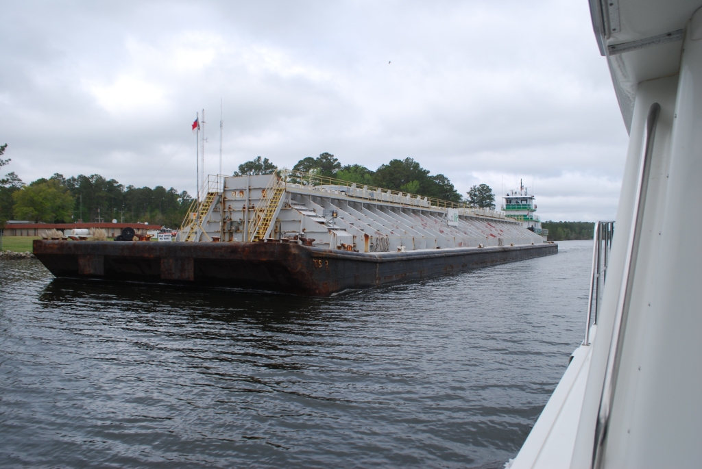
It has been a good day on Master Plan - we left Oriental at about 8:30 AM and traveled about 80 miles and arrived here at about 5:00 PM.  We saw lots of tugs/barges today - very interesting looking  ones too.  When we were cruising through the Pungo Alligator River Canal (20 straight miles), one was off to the side - we're not sure if they were resting or broken down - hard to tell.

This was an interesting looking barge - there was a sign on it - PHC Phosphate Company
This is the tug/barge was pulled over and not moving. . .
We're  back in the coffee-colored water - check out these two pictures I took off of our stern:
I took this at about 1PM - you can start to see the brownish color . . .
This one taken a few hours later - amazing the difference . . .
Cruising along the Pungo Alligator Canal - a straight shot for 20 miles . . . 

Mile Marker 105, combined with an ICW Channel Marker - our anchorage is about 3 miles north of this point.
One thing we noticed is that the ICW Mile Markers are more prevalent - there really aren't many (or any) to speak of in the southern part of the ICW.

So - tomorrow - our plan is to be in Virginia.  As many of our loyal readers know, we went through the Dismal Swamp on the way down - for this trek, we will take the other option going through Coinjock called the Virginia Cut.  It will be nice to see a different part of the ICW.  It's funny how much of each part of the ICW we recall as we head North.  There are so many wonderful parts and areas of this great waterway and how blessed we are to enjoy it - an incredible experience.

So - we'll keep you posted - sending lots of love from Master Plan - Jen & Paul

Today's Quote:
"We all have the power to give away love, to love other people. And if we do so, we change the kind of person we are, and we change the kind of world we live in."
 --Rabbi Harold Kushner

Friday, April 8, 2011

Oriental, NC - Mile 181

Greetings from Master Plan - we are in Oriental, NC after travelling 103 miles today.  It was a smooth and easy day for the most part, and we are two days away from the end of the ICW.  We waited for a few bridges, and saw a lot of interesting sites along the way . . .

This beautiful wooden boat went by us this morning prior to our leaving the dock - what a cool boat!


A surfer also paddles by as the sun rises - I love the way the sun is hitting his surfboard . . .

A large barge passes by being pushed by a tug.
Now you can see the tug!
 
We passed Camp Lejeune - some helicopters in the distance doing exercises. 

Luckily, the lights were NOT flashing!


Some "props" for training.   Camp Lejeune probably is along at least 15 miles of the ICW - it's huge.
 So - we'll head out tomorrow with our goal for another 100 miles to the Alligator River - so, as always, we'll keep you posted!

Love, Jen & Paul

Today's Quote:
It is not a disgrace not to reach the stars, but it is a disgrace to have no stars to reach for.

-Benjamin E. Mays